Official Map and Station Guide, 1958 Print
Item # 18180-20
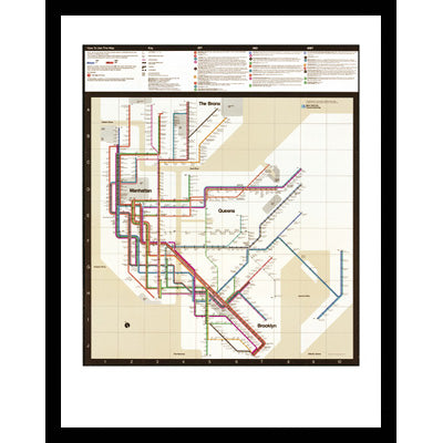
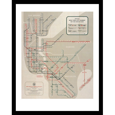
"Official New York City Map and Station Guide" 1958. Designed by George Salomon
Reproduced from the collection of the New York Transit Museum
Salomon's map for the Transit Authority - the first to show the entire system - gives the three once-separate systems equal weight and color (black, IRT; green, BMT; red, IND). Though abstract and stylized - representing the boroughs as a series of simplified gray masses - Salomon's map still bears enough similarity to the city's geography to be readily usable.
Pictured to the left framed.
Available in the following sizes:
16x20" for $33 unframed
16x20" for $104.50 framed
22x28" for $66 unframed
22x28" for $165 framed
36x48" for $104.5 unframed
Size in inches Height x Width
Paper: 16 x 20 Image: 10 15/16 x 15
Paper: 22 x 28 Image: 16 x 22
Classic black frame measures 1 1/16" wide.
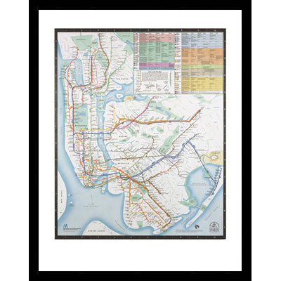